EOC Logo
  • About
  • News
  • Services
  • Maps ▾
    TanDEM-X 30m Edited Digital Elevation Model (EDEM) TanDEM-X 30m DEM Change Maps (DCM) TanDEM-X 90m DEM TanDEM-X PolarDEM 90m of Antarctica TanDEM-X Forest/Non-Forest Map SRTM X-SAR DEM
    EnMAP L0 Quicklooks
    Burnt Area Daily NRT Incremental Product - Europe, MODIS Burnt Area Daily NRT Incremental Product - Europe, Sentinel-3 Burnt Area Monthly Composite - Europe, Sentinel-3 Burnt Area Yearly Composite - Europe, Sentinel-3
    CropTypes - Crop Type Maps for Germany - Yearly, 10m GrassLands - Mowing Dynamics - Germany, 10m HedgeRows - Bavaria, 2019-2021
    MetOp GOME-2 Daily Total Column Composites Sentinel-5P TROPOMI L3 Daily Composites Sentinel-5P TROPOMI L4-DE Daily Composites
    MODIS-EU Daily Mosaic MODIS-DE Mosaic
    Sentinel-2 L2A MAJA Products Sentinel-2 L3A WASP Products
    World Settlement Footprint (WSF) - Landsat-8/Sentinel-1 - Global, 2015 World Settlement Footprint (WSF) - Sentinel-1/Sentinel-2 - Global, 2019 World Settlement Footprint (WSF) Evolution World Settlement Footprint (WSF) 3D - Global, 90m
    GUF® - Global Urban Footprint® v1 - EPSG:3857 (WGS 84 / Pseudo-Mercator) GUF® - Global Urban Footprint® v1 - EPSG:4326 (WGS84 / geocentric)
    GWP - Global WaterPack Yearly GWP - Global WaterPack Monthly SWIM Water Extent
    GSP - Global SnowPack Yearly GSP - Global SnowPack Daily GSP - Global SnowPack Mean
    TimeScan Landsat 2015
    Forest Canopy Cover Loss (FCCL) - Germany - Monthly, 10m Forest Canopy Cover Loss (FCCL) - Germany - Monthly, Administrative Level Forest Structure - Germany, Yearly Tree Canopy Cover Loss - Germany, 2018-2021 Tree Species - Sentinel-1/2 - Germany, 2022
    AVHRR - Monthly Sea Surface Temperature
    TIMELINE Level 3 - Monthly (1982-2022)
    IceLines - Ice Shelf and Glacier Front Time Series
    CORINE Land Cover Land Cover DE Road Traffic Noise - Germany, 2017
    RapidEye RESA - L3M Mosaic - Germany
    S-VELD S5P Trop. NO2 Columns (Daily/Orbit) S-VELD S5P Trop. NO2 Columns (Monthly Mean) S-VELD S5P Surface NO2 (Daily/Orbit) S-VELD S5P Surface NO2 (Monthly Mean) S-VELD MODIS/SLSTR Surface PM2.5 (Monthly Mean)
    Soil Composite Mapping Processor (SCMaP) Products (5 years) Soil Composite Mapping Processor (SCMaP) Products (30 years) SoilSuite - Sentinel-2 - Europe, 5 year composite (2018-2022) SoilSuite - Sentinel-2 - Africa, 4 year composite (2018-2021)
    UrMo Digital - Traffic Area Map (TAM) - Brunswick, Germany
    Geo-ForPy - Forest cover Paraguayan Chaco
    Residential Heat Demand - Baden Württemberg, Germany
    SAR4Tectonics (S4T)
    ECoLaSS - Evolution of Copernicus Land Services based on Sentinel Data
    fCover - Fractional Vegetation Cover Netherlands based on Sentinel-2 Data
  • Downloads ▾
    EnMAP - Environmental Mapping and Analysis Program DESIS - DLR Earth Sensing Imaging Spectrometer
    fCover Sentinel-2 Netherlands
    Forest Canopy Cover Loss Germany Forest Structure Germany Tree Species Germany
    Geo-ForPy - Forest Cover Paraguayan Chaco
    CropTypes - Crop Type Maps for Germany GrassLands - Mowing Dynamics HedgeRows - Bavaria, 2019-2021
    GWP - Global WaterPack SWIM - Surface Water Inventory and Monitoring (SWIM) Water Extent
    GSP - Global SnowPack
    IceLines - Ice Shelf and Glacier Front Time Series PolarLakes - Sentinel-1/2 - Antarctica
    Land Cover DE
    Sentinel-2 L2A MAJA Sentinel-2 L3A WASP Sentinel-5p Tropomi
    S-VELD NO2 and PM2.5
    SOILSUITE
    SRTM X-SAR DEM
    TanDEM-X 30m Edited Digital Elevation Model (EDEM) TanDEM-X 30m DEM Change Maps (DCM) TanDEM-X 90m DEM TanDEM-X Forest/Non-Forest Map TanDEM-X PolarDEM Antarctica
    TerraSAR-X Supersites
    TIMELINE Level 3 - Monthly (1982-2022)
    Tree Canopy Cover Loss - Germany, 2018-2021
    UrMo Digital - Traffic Area Map (TAM) - Brunswick, Germany
    World Settlement Footprint 2015 World Settlement Footprint 2019 World Settlement Footprint Evolution World Settlement Footprint 3D World Settlement Footprint 3D Material Stock
  • Data Guides ▾
    SRTM X-SAR DEM TanDEM-X 30m EDEM and DCM TanDEM-X 90m DEM TanDEM-X FNF 50m
DLR Logo
Due to technical maintenance, some interruptions in our (OGC-) services might occur.

World Settlement Footprint (WSF) 2019 - Sentinel-1/2 - Global

Thumbnail - WSF2019

Abstract

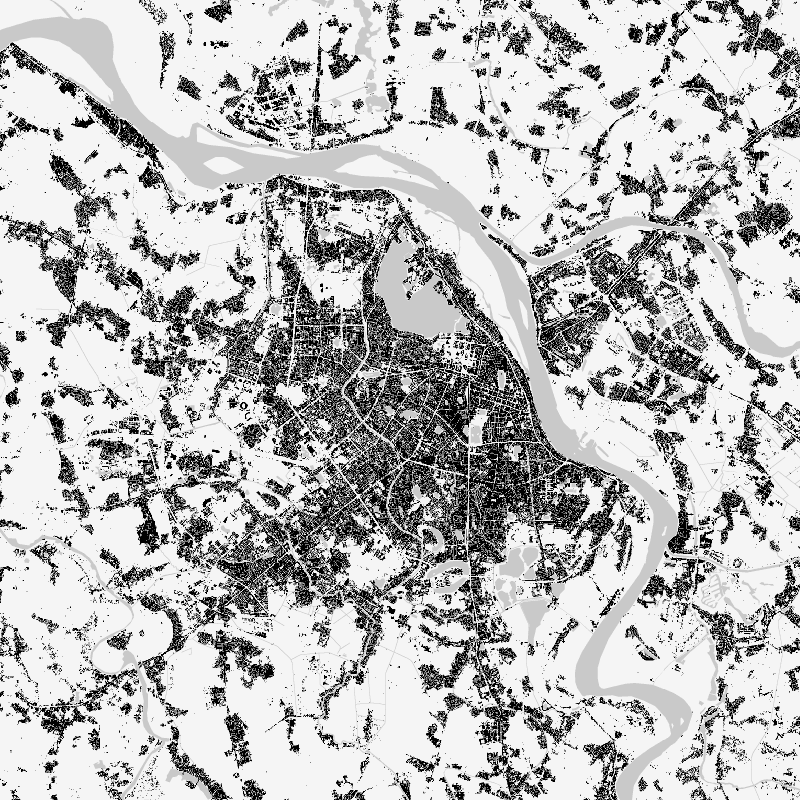
The World Settlement Footprint (WSF) 2019 is a 10m resolution binary mask outlining the extent of human settlements globally derived by means of 2019 multitemporal Sentinel-1 (S1) and Sentinel-2 (S2) imagery. Based on the hypothesis that settlements generally show a more stable behavior with respect to most land-cover classes, temporal statistics are calculated for both S1- and S2-based indices. In particular, a comprehensive analysis has been performed by exploiting a number of reference building outlines to identify the most suitable set of temporal features (ultimately including 6 from S1 and 25 from S2). Training points for the settlement and non-settlement class are then generated by thresholding specific features, which varies depending on the 30 climate types of the well-established Köppen Geiger scheme. Next, binary classification based on Random Forest is applied and, finally, a dedicated post-processing is performed where ancillary datasets are employed to further reduce omission and commission errors. Here, the whole classification process has been entirely carried out within the Google Earth Engine platform. To assess the high accuracy and reliability of the WSF2019, two independent crowd-sourcing-based validation exercises have been carried out with the support of Google and Mapswipe, respectively, where overall 1M reference labels have been collected based photointerpretation of very high-resolution optical imagery.

Contact

  • geoservice@dlr.de
    German Aerospace Center (DLR)
  • mattia.marconcini@dlr.de
    German Aerospace Center (DLR)
  • wsf@dlr.de
    DLR/EOC Land Surface Dynamics
  • geoservice@dlr.de
    German Aerospace Center (DLR)

Keywords

  • opendata
  • global
  • urbanization
  • land
  • global settlement extent
  • Sentinel-1
  • Sentinel-2
  • inspireidentifiziert
  • GEMET - INSPIRE themes, version 1.0
  • Land cover

License

  • Nutzungseinschränkungen: Das DLR ist nicht haftbar für Schäden, die sich aus der Nutzung ergeben. / Use Limitations: DLR not liable for damage resulting from use.
  • Nutzungsbedingungen: Lizenz, https://creativecommons.org/licenses/by/4.0 / terms of use
  • {"id": "cc-by/4.0",
  • "name": "Creative Commons Namensnennung – 4.0 International (CC BY 4.0)",
  • "url": "http://dcat-ap.de/def/licenses/cc-by/4.0",
  • "quelle": "Copyright DLR (2021)"}

Links

  • Download Metadata (.xml)

Last Update: 2025-02-03

Please wait...

Download

Select Items:

Keep Ctrl pressed to select Bounding Box.


No items selected


time limit
1 month
Year Month Day Custom
--
to
--

Custom Interval

Geoservice

Contact | Privacy | Terms | Imprint

Partner

DLR Portal | EOC Portal | EOWEB© GeoPortal