EOC Logo
  • About
  • News
  • Services
  • Maps ▾
    TanDEM-X 30m Edited Digital Elevation Model (EDEM) TanDEM-X 30m DEM Change Maps (DCM) TanDEM-X 90m DEM TanDEM-X PolarDEM 90m of Antarctica TanDEM-X Forest/Non-Forest Map SRTM X-SAR DEM
    EnMAP L0 Quicklooks
    Burnt Area Daily NRT Incremental Product - Europe, MODIS Burnt Area Daily NRT Incremental Product - Europe, Sentinel-3 Burnt Area Monthly Composite - Europe, Sentinel-3 Burnt Area Yearly Composite - Europe, Sentinel-3
    CropTypes - Crop Type Maps for Germany - Yearly, 10m GrassLands - Mowing Dynamics - Germany, 10m HedgeRows - Bavaria, 2019-2021
    MetOp GOME-2 Daily Total Column Composites MetOp GOME-2 Level 3 Daily Total Column Composites Sentinel-5P TROPOMI L3 Daily Composites Sentinel-5P TROPOMI L4-DE Daily Composites
    MODIS-EU Daily Mosaic MODIS-DE Mosaic
    Sentinel-2 L2A MAJA Products Sentinel-2 L3A WASP Products
    World Settlement Footprint (WSF) - Landsat-8/Sentinel-1 - Global, 2015 World Settlement Footprint (WSF) - Sentinel-1/Sentinel-2 - Global, 2019 World Settlement Footprint (WSF) Evolution World Settlement Footprint (WSF) 3D - Global, 90m
    GUF® - Global Urban Footprint® v1 - EPSG:3857 (WGS 84 / Pseudo-Mercator) GUF® - Global Urban Footprint® v1 - EPSG:4326 (WGS84 / geocentric)
    GWP - Global WaterPack Yearly GWP - Global WaterPack Monthly SWIM Water Extent
    GSP - Global SnowPack Yearly GSP - Global SnowPack Daily GSP - Global SnowPack Mean
    TimeScan Landsat 2015
    Forest Canopy Cover Loss (FCCL) - Germany - Monthly, 10m Forest Canopy Cover Loss (FCCL) - Germany - Monthly, Administrative Level Forest Structure - Germany, Yearly Tree Canopy Cover Loss - Germany, 2018-2021 Tree Species - Sentinel-1/2 - Germany, 2022
    AVHRR - Monthly Sea Surface Temperature
    TIMELINE Level 3 - Monthly (1982-2022)
    IceLines - Ice Shelf and Glacier Front Time Series
    CORINE Land Cover Land Cover DE Road Traffic Noise - Germany, 2017
    RapidEye RESA - L3M Mosaic - Germany
    S-VELD S5P Trop. NO2 Columns (Daily/Orbit) S-VELD S5P Trop. NO2 Columns (Monthly Mean) S-VELD S5P Surface NO2 (Daily/Orbit) S-VELD S5P Surface NO2 (Monthly Mean) S-VELD MODIS/SLSTR Surface PM2.5 (Monthly Mean)
    Soil Composite Mapping Processor (SCMaP) Products (5 years) Soil Composite Mapping Processor (SCMaP) Products (30 years) SoilSuite - Sentinel-2 - Europe, 5 year composite (2018-2022) SoilSuite - Sentinel-2 - Africa, 4 year composite (2018-2021)
    UrMo Digital - Traffic Area Map (TAM) - Brunswick, Germany
    Geo-ForPy - Forest cover Paraguayan Chaco
    Residential Heat Demand - Baden Württemberg, Germany
    SAR4Tectonics (S4T)
    ECoLaSS - Evolution of Copernicus Land Services based on Sentinel Data
    fCover - Fractional Vegetation Cover Netherlands based on Sentinel-2 Data
  • Downloads ▾
    EnMAP - Environmental Mapping and Analysis Program DESIS - DLR Earth Sensing Imaging Spectrometer
    fCover Sentinel-2 Netherlands
    Forest Canopy Cover Loss Germany Forest Structure Germany Tree Species Germany
    Geo-ForPy - Forest Cover Paraguayan Chaco
    CropTypes - Crop Type Maps for Germany GrassLands - Mowing Dynamics HedgeRows - Bavaria, 2019-2021
    GWP - Global WaterPack SWIM - Surface Water Inventory and Monitoring (SWIM) Water Extent
    GSP - Global SnowPack
    IceLines - Ice Shelf and Glacier Front Time Series PolarLakes - Sentinel-1/2 - Antarctica
    Land Cover DE
    Sentinel-2 L2A MAJA Sentinel-2 L3A WASP Sentinel-5p Tropomi
    S-VELD NO2 and PM2.5
    SOILSUITE
    SRTM X-SAR DEM
    TanDEM-X 30m Edited Digital Elevation Model (EDEM) TanDEM-X 30m DEM Change Maps (DCM) TanDEM-X 90m DEM TanDEM-X Forest/Non-Forest Map TanDEM-X PolarDEM Antarctica
    TerraSAR-X Supersites
    TIMELINE Level 3 - Monthly (1982-2022)
    Tree Canopy Cover Loss - Germany, 2018-2021
    UrMo Digital - Traffic Area Map (TAM) - Brunswick, Germany
    World Settlement Footprint 2015 World Settlement Footprint 2019 World Settlement Footprint Evolution World Settlement Footprint 3D World Settlement Footprint 3D Material Stock
  • Data Guides ▾
    SRTM X-SAR DEM TanDEM-X 30m EDEM and DCM TanDEM-X 90m DEM TanDEM-X FNF 50m
DLR Logo
null

Sentinel-2 MSI - Level 2A (MAJA Tiles) - Germany

Thumbnail - S2_L2A_MAJA

Abstract

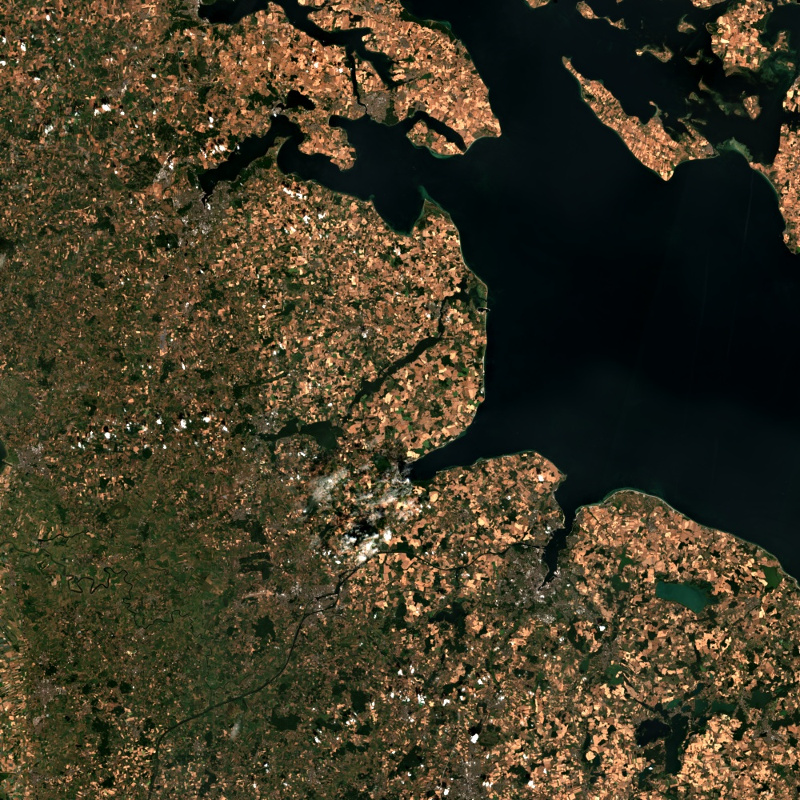
This collection contains Sentinel-2 Level 2A surface reflectances, which are computed for the country of Germany using the time-series based MAJA processor. During the Level 2A processing, the data are corrected for atmospheric effects and clouds and their shadows are detected. The MAJA L2A product is available online for the last 12 months. Further data are kept in the archive and are available upon request. Please see https://logiciels.cnes.fr/en/content/maja for additional information on the MAJA product. The MAJA product offers an alternative to the official ESA L2A product and has been processed with consideration of the characteristics of the Sentinel-2 mission (fast collection of time series, constant sensor perspective, and global coverage). Assumptions about the temporal constancy of the ground cover are taken into account for a robust detection of clouds and a more flexible determination of aerosol properties. As a result, an improved determination of the reflectance of sunlight at the earth's surface (pixel values of the multispectral image) is derived. Further Sentinel-2 Level 2A data computed using MAJA are available on the following website: https://theia.cnes.fr

Contact

  • Pablo.Angelo@dlr.de
    German Aerospace Center (DLR)
  • geoservice@dlr.de
    German Aerospace Center (DLR)

Keywords

  • Satellite
  • Earth Observation
  • Multispectral
  • Sentinel-2
  • MSI
  • Level 2A
  • MAJA
  • DLR
  • Atmospheric Correction
  • Cloud Detection
  • Germany
  • GEMET - INSPIRE themes, version 1.0
  • Orthoimagery
  • Spatial scope
  • National

License

  • Nutzungseinschränkungen: Das DLR ist nicht haftbar für Schäden, die sich aus der Nutzung ergeben. / Use Limitations: DLR not liable for damage resulting from use.
  • Nutzungsbedingungen / Terms of use: The Sentinel-2 level 2A data produced and distributed by DLR are based on Copernicus Sentinel-2 level 1C data, which are subject to the following license
  • {"id": "cc-by-4.0",
  • "name": "Creative Commons Namensnennung 4.0 International (CC BY 4.0)",
  • "url": "https://www.dcat-ap.de/def/licenses/",
  • "quelle": "German Aerospace Center (DLR): Sentinel-2 MSI - Level 2A (MAJA Tiles) - Germany, DOI: 10.15489/ifczsszkcp63 or Contains modified Copernicus Sentinel data, processed by DLR, licensed under CC BY 4.0"}

Links

  • Download Metadata (.xml)

Last Update: 2025-07-22

Please wait...

Download

Select Items:

Keep Ctrl pressed to select Bounding Box.


No items selected


time limit
1 month
Year Month Day Custom
--
to
--

Custom Interval

Geoservice

Contact | Privacy | Terms | Imprint

Partner

DLR Portal | EOC Portal | EOWEB© GeoPortal